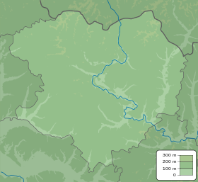
Yakovenkove, Kharkiv Oblast
Appearance
Yakovenkove
Яковенкове | |
|---|---|
| Coordinates: 49°31′44″N 36°54′54″E / 49.528973°N 36.91498°E | |
| Country | |
| Oblast | |
| Raion | Izium Raion |
| Area | |
| • Total | 2.278 km2 (0.880 sq mi) |
| Elevation | 93 m (305 ft) |
| Population | |
| • Total | 1,123 |
| • Density | 490/km2 (1,300/sq mi) |
| Time zone | UTC+2 (EET) |
| • Summer (DST) | UTC+3 (EEST) |
| Postal code | 64225 |
| Area code | +380 5749 |
 | |
Yakovenkove (Ukrainian: Яковенкове; Russian: Яковенково), also known as Iakovenkove, is a village in Izium Raion (district) in Kharkiv Oblast of eastern Ukraine, at about 71.5 kilometres (44.4 mi) southeast by east (SEbE) from the centre of Kharkiv city, at about 4 kilometres (2.5 mi) north-northeast (NNE) from the northern border of Balakliia (Balakliya).
The settlement came under attack by Russian forces during the Russian invasion of Ukraine in 2022 and was regained by Ukrainian forces by the beginning of September the same year.[2]
References
[edit]- ^ "Офіційна сторінка Всеукраїнського перепису населення | Банк даних" [All-Ukrainian population census | Database]. ukrcensus.gov.ua (in Ukrainian). Retrieved 29 December 2022.
- ^ Karolina Hird; Grace Mappes; George Barros; Layne Philipson; Mason Clark (13 October 2022). "Russian Offensive Campaign Assessment, September 7". understandingwar.org. ISW. Retrieved 29 December 2022.
Geolocated footage shows that Ukrainian forces also advanced northeast along the T2110 highway from Balakliya, Verbivka, Yakovenkove, Volokhiv Yar (at the intersection of the T2210 and E40), and towards Shevchenkove (at the intersection of the T2210 and N26).


